eNews
#03 2025
Exploring the hidden: My journey in geohydrology and passion for groundwater
By Mkholo Maseko, Groundwater Hydrologist, Grasslands Node, NRF-SAEON
Groundwater studies have been a passion of mine since my Honours year. Lake Sibaya in the Maputaland Coastal Plain region of northern KwaZulu-Natal has been the base for my exploration of groundwater processes. From analysing groundwater level data to illustrating groundwater seepage into the ocean using thermal remote sensing imagery, I began to carve a path toward a future in geohydrology.
My master’s degree focused on groundwater modelling of the Lake Sibaya system, a component I was fortunate to continue developing during my time as a junior hydrologist at SAEON. My experience at SAEON has been both memorable and eye-opening. From developing professional etiquette to exploring diverse avenues for geohydrological collaboration with industry specialists, the experience has been invaluable.
A particular highlight has been contributing to a Water Research Commission (WRC – South Africa’s leading water knowledge hub) project by performing the groundwater modelling work, which became a notable achievement in my career. This role provided a unique opportunity to identify critical gaps in groundwater–surface water interaction studies, particularly in the Lake Sibaya area, while also allowing me to examine global approaches to addressing similar challenges.
Current research focus – groundwater recharge
My passion for learning and a deepening understanding of groundwater processes have led me to pursue a PhD at Stellenbosch University, starting this year, under a National Research Foundation (NRF) ring-fenced bursary. My research is driven by questions emanating from the WRC project, particularly those related to groundwater recharge, which formed the foundation of my study.
Groundwater recharge refers to the process by which water (typically from rainfall) infiltrates the soil and percolates down into an aquifer, a saturated zone beneath the ground that acts as a natural reservoir. This hydrological process is one of the most important, yet often overlooked, components of water resource management.
Groundwater reserves, upon which approximately 70% of the population in southern African countries depend (refer to World Bank, 2017), require regular replenishment. Understanding how much, how frequently, and where this process is most active has significant implications for land-use planning and water resource management.
Currently, there is a valuable opportunity to assess the performance of innovative tracer-aided modelling approaches aimed at improving the estimation of surface water partitioning (the separation of rainfall into its contributing components such as runoff, evapotranspiration and recharge). In this context, tracer-aided models refer to hydrological models that incorporate environmental tracers, i.e. naturally occurring chemical isotopes. Due to the distinct behaviours of specific isotopes, these tracers can be used to identify the origin and movement of water through the hydrological system and help improve model accuracy.
Previous methods for quantifying groundwater recharge, particularly in rural and data-scarce regions, carried considerable uncertainty. For example, a WRC project I contributed to found that the use of climate reanalysis products resulted in an underestimation of rainfall, leading to an estimated 30% underestimation of groundwater recharge (refer to van Rensburg et al., 2024). Although earlier techniques such as the Chloride Mass Balance (CMB) method have been employed in the area, they have not maintained widespread support considering more recent and less data intensive methodological advancements.
My research will utilise both stable and radioactive water isotopes as environmental tracers in tracer-aided modelling. However, when quantifying groundwater recharge, land use (including pasture, forestry plantations) and land cover (grassland, forest, swamp), collectively referred to as LULC (Land Use and Land Cover), are critical concepts to consider. Numerous studies have demonstrated that LULC decisions strongly influence the partitioning of rainfall into deep soil percolation and aquifer recharge.
Case study – Lake Sibaya Maputaland Coastal Plain area
A prime example is the Lake Sibaya Maputaland Coastal Plain area. This region is one of the SAEON Grasslands Node’s research platforms and is entirely dependent on groundwater, unlike most other parts of South Africa where rivers and dams serve as primary water sources.
In the Lake Sibaya catchment, groundwater is solely replenished by rainfall, as no rivers flow into the catchment. This hydrological setup has made the area a focal point for water resource management concerns, particularly in the context of ongoing land-use changes and emerging climate change impacts.
To illustrate the impact of land use, studies have shown that grasslands in the region support nearly twice as much groundwater recharge as areas under commercial forestry (such as eucalyptus or pine plantations). In contrast, commercial forestry significantly reduces recharge due to its high water demand and deep-rooted vegetation, posing a potential threat to the long-term sustainability of groundwater resources.
The Lake Sibaya area offers a valuable case study for assessing innovative techniques for representing critical hydrological processes. Taking advantage of this, my PhD will also incorporate isotope-enabled global and regional spectral models (IsoGSM and IsoRSM), large-scale climate models with an isotope simulation component, to improve the accuracy of precipitation inputs. These refined datasets will then inform an isotope-enabled Rainfall–Runoff model (J2000-Iso) to enhance the partitioning of rainfall into its various components, with a primary emphasis on subsurface flow and groundwater recharge.
View of the cut-off lake connected to the southwestern arm of Lake Sibaya.
Participatory and active community engagement
Despite the complexity of the study, lessons from the previous WRC project highlighted the importance of participatory and active community engagement in designing scientific projects that not only advance academic knowledge but also deliver societal benefits. Building on this experience, the current study incorporates citizen science in the data collection process, where community participation plays a pivotal role in collecting event-based rainfall isotope data for use in tracer-aided models.
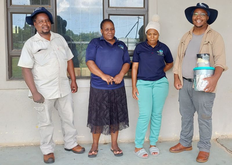
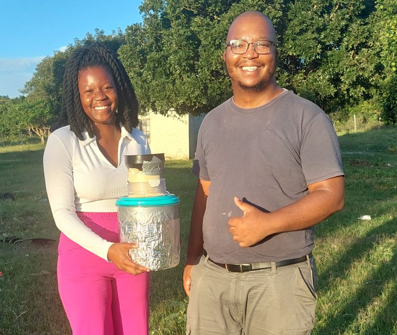
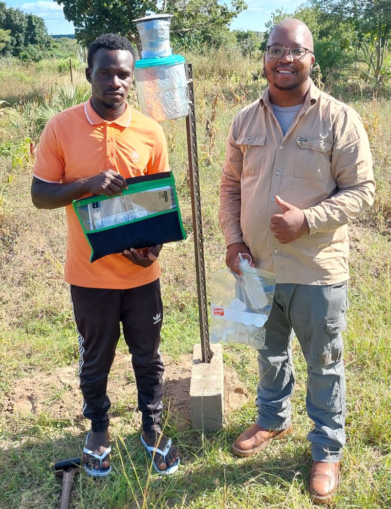
Rainfall samplers were made by adapting the design outlined in an article by Holmes et al. (2023). The sampling process for my research requires event-based rainfall collection, necessitating the active involvement of community members from the study area to gather rainfall samples during precipitation events. Three community members were selected from each side of the lake – north, west and south. Rainfall samplers were installed at a standard height, and the participants were trained in sample collection procedures, including proper storage and documentation of metadata. The goal is to collect samples monthly.
In collaboration with NRF-iThemba LABS, the stable isotope samples from rainfall will be sent monthly for laboratory analysis.
Acknowledgements
This study acknowledges funding from the NRF and SAEON. The student is affiliated with Stellenbosch University and based at the SAEON Grasslands Node in Pietermaritzburg. The PhD is supervised by Dr Amy Allwright, Dr Andrew Watson and Dr Michele Toucher (SAEON).
For further reading
van Rensburg, Susan Janse, Ross Blamey, James Blignaut, Paul Gordijn, Nokwanda Gule, Seifu Kebede, Bruce Kelbe, et al. 2024. Advancing Water and Income Security in the Unique Maputaland Coastal Plain: A Strategic Decision Support Tool to Explore. Water Research Commission (WRC), Project No. C2020/2021-00430.
World Bank. 2017. Hidden and Forgotten: Managing Groundwater in Southern Africa. Available at: https://www.worldbank.org/en/news/feature/2017/06/07/hidden-and-forgotten-managing-groundwater-in-southern-africa#:~:text=It’s%20estimated%20that%20at%20least,ecosystem%20health%2C%20and%20industrial%20growth
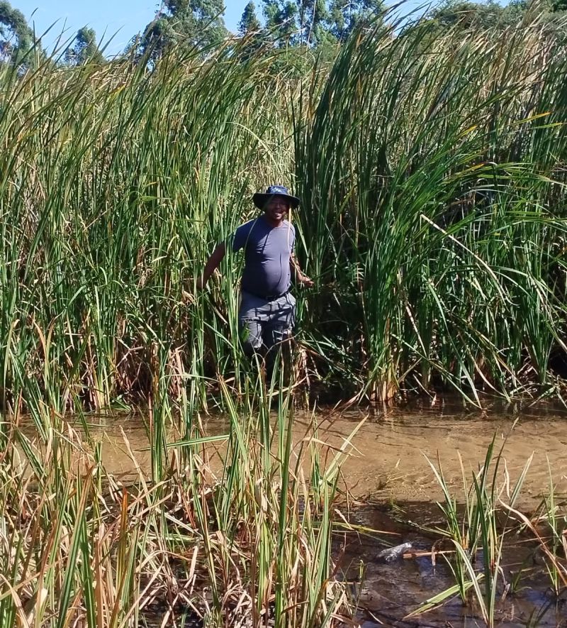
Accessing a borehole on the Mseleni Stream, which feeds into the western arm of Lake Sibaya.
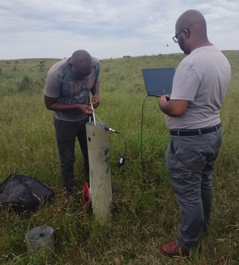
Downloading measured data from SIB01B borehole on the northern side of Lake Sibaya.
Community participants for collecting rainfall samples.
Constructing rainfall samplers at the SAEON Grasslands Node in Pietermaritzburg.
“We are facing both an economic and a climate crisis that are connected via the energy sector. Both will benefit from a move towards clean energy.” – Johan Pauw
